Tools and research to support Marine Spatial Planning in Belgium
Tools
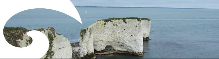
Kustatlas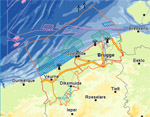
The coastal atlas for Flanders/Belgium was completed in 2005 and offers an overview of the Belgian coast. The digital coastal atlas was fully reviewed in the framework of the C-SCOPE project. The updated, interactive coastal atlas is a portal site for coastal actors and interested individuals, which can be used as a policy supporting tool. One of its assets are the unique integrating/combined maps that are not available on any other forum.
Research
Plan de gestion maritime en Belgique – Analyse du période 2000-2011En Europe tout comme dans les pays individuels le PSM est un sujet clé se trouvant en haut de l'ordre du jour. Ces dernières années, de nouveaux développements se manifestaient également en Belgique. Cet inventaire fournit un état des affaires sur l'aménagement spatial dans la partie Belge de la Mer du Nord et ce au niveau projet comme au niveau politique. La structure de l'inventaire se conforme au guide sur la 'Marine Spatial Planning' de l'UNESCO’. Les 10 étapes développent les différents phases et éléments d'un processus de gestion marine.
GAUFRE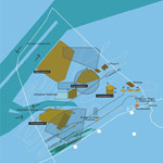
The aim of the GAUFRE project (2003-2005) was to build the scientific foundations that would allow for the development of a spatial structure plan for the Belgian section of the North Sea. The underlying reason was the increasing demand for activities at sea and the importance of a spatial planning process for the different North Sea states. GAUFRE was the first step towards such a structure plan that would take into account possible conflicts between various interested parties and an active participation on behalf of those parties and the general public.
BWZeeBWZee was a project that ran for two years (April 2004-March 2006) and that was carried out by five Belgian research groups in the framework of the Federal Science Policy. Its objective was to develop a scientifically acceptable appreciation strategy for marine areas that could be applied in various ways and to apply that strategy to the Belgian Continental Shelf (BCS). The final product was an integrated, biological appreciation map that determined the biological and ecological value of every subarea on the BCS.
MESMAThe MESMA project aims to offer a tool that would streamline spatial management of the marine environment in Europe in several respects. An essential part of the project is the establishment of an ‘open’ database with information on (1) the dispersion of marine habitats and species, (2) economic values and benefits and (3) human activities and impacts. This database is to become the interface between science, politicians and policymakers.
And the spatial planners have also been busy:
- The Masterplan Zeekracht of the Office for Metropolitan Architecture (OMA) considered possible locations for wind turbines in the North Sea, which together form the symbolic ‘North Sea ring’
- The spatial manifesto M.U.D.was the FLC’s attempt to start the debate on planning in the coastal area. FLC, a free association of designers, town planners and artists, used the scenario of a sea level rise in order to create a proactive coastal image. The request for that exercise did not emerge from an authority that was looking for an approach to concrete policy issues but from the Flemish Architecture Institute, that had been invited to be the curator during Rotterdam’s International Architecture Biennale, the theme of which was ‘Deluge’. The final result was not a scientific report, but artefacts (exhibition, tapestry, video, pamphlet, …)
- Architects and spatial planners Charlotte Geldof and Nel Janssens drafted a critical essay on spatial planning at sea: Marine spatial Planning – a critical vision and the importance of the commons.
- Le Future Commons 2070 examine l'avenir de la partie sud de la Mer du Nord.
La cartographie subjective, résultant de cette recherche conceptuelle, en constitue l’expression artistique, à l’intersection de l’art, l’architecture et de l’urbanisme. Elle étonne par sa puissance visionnaire.
Cette carte marine anno 2070 est une vision critique de l'avenir qui plaide pour un aménagement maritime du territoire où la mer est validée comme bien commun. La carte explore l'avenir de la partie méridionale de la Mer du Nord et de ses zones côtières adjacentes. Le Future Commons 2070 est un projet de recherche de magnificentsurroundings.org, un groupe indépendant d'urbanistes, d'architectes, de designers et de penseurs, qui veulent esquisser les problèmes sociaux par le biais de la recherche conceptuelle.
Additionally, there was a remarkable initiative on behalf of private entrepreneurs: ‘Flanders Bays 2100’. From the autumn of 2008 until the spring of 2009 a consortium of Flemish dredging companies and consulting firms elaborated the project ‘Flanders Bays 2100’, which is to initiate a vision on a sustainable future for the coast.

