Tools and research to support Marine Spatial Planning in Belgium
Tools
Kustatlas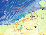
The coastal atlas for Flanders/Belgium was completed in 2005 and offers an overview of the Belgian coast. The digital coastal atlas was fully reviewed in the framework of the C-SCOPE project. The updated, interactive coastal atlas is a portal site for coastal actors and interested individuals, which can be used as a policy supporting tool. One of its assets are the unique integrating/combined maps that are not available on any other forum.
Research
Marine Spatial Plannin in Belgium – Analysis of the period 2000-2011In Europe but also in individual member countries MSP was set high on the agenda. In recent years there have already been new developments in Belgium in spatial planning at sea and at the coast. During the period 2000-2010, different processes developed parallel or consecutive on marine spatial planning (sea and coast). This inventory gives a state of affairs on spatial planning in the Belgian part of the North Sea, on policy as well as on project level.
The inventory has been structured in analogy with the UNESCO Guide on marine Spatial Planning. Each of the 10 steps illustrate a different phase and different elements of the marine management process.
The aim of the GAUFRE project (2003-2005) was to build the scientific foundations that would allow for the development of a spatial structure plan for the Belgian section of the North Sea. The underlying reason was the increasing demand for activities at sea and the importance of a spatial planning process for the different North Sea states. GAUFRE was the first step towards such a structure plan that would take into account possible conflicts between various interested parties and an active participation on behalf of those parties and the general public.
BWZeeBWZee was a project that ran for two years (April 2004-March 2006) and that was carried out by five Belgian research groups in the framework of the Federal Science Policy. Its objective was to develop a scientifically acceptable appreciation strategy for marine areas that could be applied in various ways and to apply that strategy to the Belgian Continental Shelf (BCS). The final product was an integrated, biological appreciation map that determined the biological and ecological value of every subarea on the BCS.
MESMAThe MESMA project aims to offer a tool that would streamline spatial management of the marine environment in Europe in several respects. An essential part of the project is the establishment of an ‘open’ database with information on (1) the dispersion of marine habitats and species, (2) economic values and benefits and (3) human activities and impacts. This database is to become the interface between science, politicians and policymakers.
And the spatial planners have also been busy:
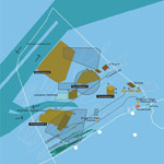
- The Masterplan Zeekracht of the Office for Metropolitan Architecture (OMA) considered possible locations for wind turbines in the North Sea, which together form the symbolic ‘North Sea ring’
- The spatial manifesto M.U.D.was the FLC’s attempt to start the debate on planning in the coastal area. FLC, a free association of designers, town planners and artists, used the scenario of a sea level rise in order to create a proactive coastal image. The request for that exercise did not emerge from an authority that was looking for an approach to concrete policy issues but from the Flemish Architecture Institute, that had been invited to be the curator during Rotterdam’s International Architecture Biennale, the theme of which was ‘Deluge’. The final result was not a scientific report, but artefacts (exhibition, tapestry, video, pamphlet, …)
- Architects and spatial planners Charlotte Geldof and Nel Janssens drafted a critical essay on spatial planning at sea: Marine spatial Planning – a critical vision and the importance of the commons.
- The Future Commons 2070 examines the future of the southern North Sea. It is the result of a research by design proces. The artistic expression of this is subjective cartography that is located at the intersection between art, architecture and urbanism and surprises by its visionary power. This chart anno 2070 is a critical vision that advocates for maritime spatial planning in which the sea is validated as a common good. It explores the future for the southern North Sea in Europe and its adjacent coastal zones.
The Future Commons 2070 is a research project of magnificentsurroundings.org, an independent group of urban planners, architects, designers and thinkers , who use design based research to adress in a critical way socio-ecological issues our society is confronted with today.
Additionally, there was a remarkable initiative on behalf of private entrepreneurs: ‘Flanders Bays 2100’. From the autumn of 2008 until the spring of 2009 a consortium of Flemish dredging companies and consulting firms elaborated the project ‘Flanders Bays 2100’, which is to initiate a vision on a sustainable future for the coast.

